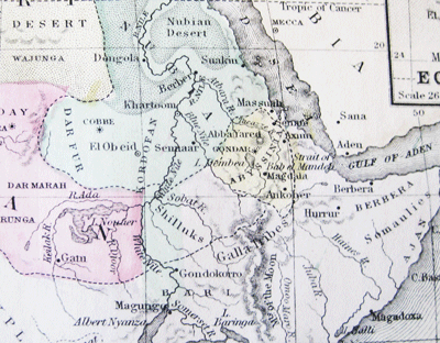
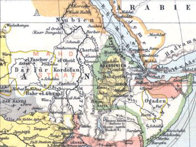
The map history of an unhappy place, 1829-present
In the greater Horn of Africa, the talk is of civil war, genocide, tyranny, interstate war, failed states, fragile peace. Where did this all come from? One perspective is given from Europeans' maps of this area. The maps below are cropped so as to cover the exact same area from the Tropic of Cancer to the Equator, from 20 degrees longitude to the tip of the horn (approx. 50 degrees longitude). The maps are from early 1800s (exact data unknown), 1829, 1885, 1906, 1924, and the Present. The place names appear early on: Darfur, Somalia, (or earlier versions of those names, like Nubia for Sudan, Abyssinia for Ethiopia), but the borders are remarkably unstable.
Among the forces at work changing the map are Europeans’ increasing knowledge of the area, the expansion of European colonial control, European border changes, and Ethiopian expansion. Somehow it led to the present mix of tragic mess, cultural richness, and potential for hope.
 From Aid to Equality


